Duration: 09/01/2018-09/06/2018
Outline: Denver – Rocky Mountain NP (2.5 day) – Great Sand Dunes NP (1 day) – Denver
Keyword: Road trip; Hiking; Alpine; Sand Dunes
Colorado is an ideal destination for people who likes traveling. Aspen Mountain is the holy place for skiing in winter. Four national parks (Rocky Mountain, Great Sand Dunes, Black Canyon of the Gunnison, and Mesa Verde) provide most diverse and gorgeous scenery. Multiple rivers, lakes, and mountain streams let Western Colorado become one of the best destination for fly fishing.
The idea of visiting Colorado just came in mind 10 days before the planned setting off date. I have thought about this popular place for many times, but it’s really hard for me to find a two-three week vacation to cover all places in one trip. Then I just decided to break it down to several small trips. This blog recorded the days I spent in Denver, Rocky Mountain NP, and Great Sand Dunes NP during Labor Day Holiday.
– Denver –
Since Denver is the hub for United Airlines, the flight ticket usually cost less compared to other airline companies. I bought a non-stop ticket and after 2.5 hour flight I arrived at Denver International Airport at ~10am. (Well, I typically don’t choose United Airlines, for some reasons you know…) As my travel companions would arrive at different time, we have already decided to self-plan the first day in Denver. So what I was going to do is, taking the train to downtown, checking in at the hotel, and visiting Denver Art Museum.
RTD (Regional Transport District) is a public transport service system in Denver. The University of Colorado A Line and SkyRide Bus offer services to Denver International Airport from anywhere within RTD for just $9.[1] A Line connects downtown Denver Union Station with airport and takes about 40 minutes. Typically, it would cost similar amount of time for driving or even more due to bad traffic. I would recommend book a hotel in downtown area if you plan to visit the art museum and spend some time on the 16th street. Here are all stops for A Line:

Denver Art museum is free admission on first Saturday each month. I joined a landscape photography tour called “New Territory: Landscape Photography Today“. This exhibit contains over 100 photographs explored the connection between human being and environment and demonstrated the innovative techniques used to depict landscapes. For example, Shimpei Takeda is a Japanese artist working with photographic materials. He used camera-less process to record Fukushima Daiichi Nuclear disaster in series “Trace“. The series captured the radiation from nuclear contaminated residues.[2]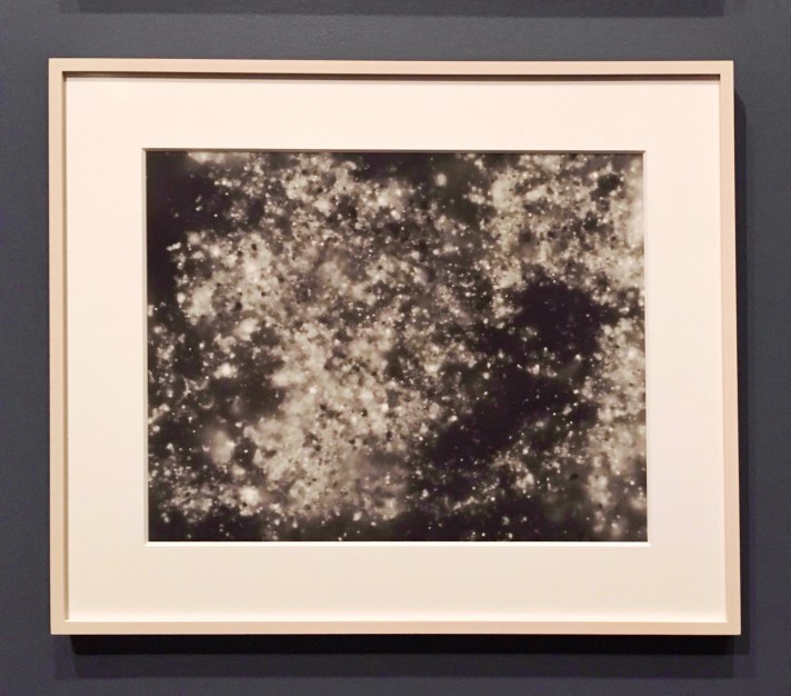
Matthew Brandt is an artist based on Los Angelas, CA. His “Wai’anae” project reflects the regeneration and the beauty of Hawaiian rain forest. Matthew rolled the prints he captured of the Hawaiian rain forest in burlap and buried them underground. He wants to let the land to compose and penetrate his artwork.[3]
– Rocky Mountain National Park –
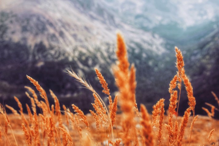
Rocky Mountain National Park is located at northwest of Denver and situated between the Estes Park (east) and the Grand Lake (west). It is one of the most visited and is the highest national park across nation, with the highest point of which is Long Peak. The park is very famous for its spectacular landscape for mountain tundra and alpine lakes. Its over 100 hiking trails are usually categorized in five geographic regions (copyrighted info). During two days and a half, we road trip the region 1 and 2, and did two hikes in region 4 and 5.
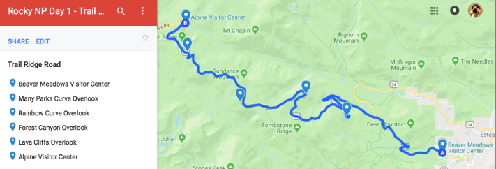
Day 1: Trail Ridge Road – Bear Lake – Nymph Lake
After one and half drive from Denver, we arrived RMNP around 12pm. The first stop is the Beaver Meadow Visitor Center. Beaver Meadow is the headquarter among all six visitor centers in RMNP.[4] I initially planned to visit Bear Lake first and hike the lake trails towards Emerald Lake. Unfortunately, I was told that the Bear Lake parking lot was closed due to high volume of the visitors and this situation almost happens everyday. Here are some tips I want to share for those who plan to visit Bear Lake area: 1) Go early or late. Due to its popularity, the parking lot usually close at 8am to 9:30am.[5] So you probably want to go early before 8am or late after 4pm; 2) Find a nearby parking lot. Glacier Gorge Junction trailhead is just 1 mile away from Bear Lake trailhead. If you’re lucky, you might be able to find a place to park at Glacier Gorge in the morning; 3) Take a bus is another option to avoid limited parking (bus schedule).
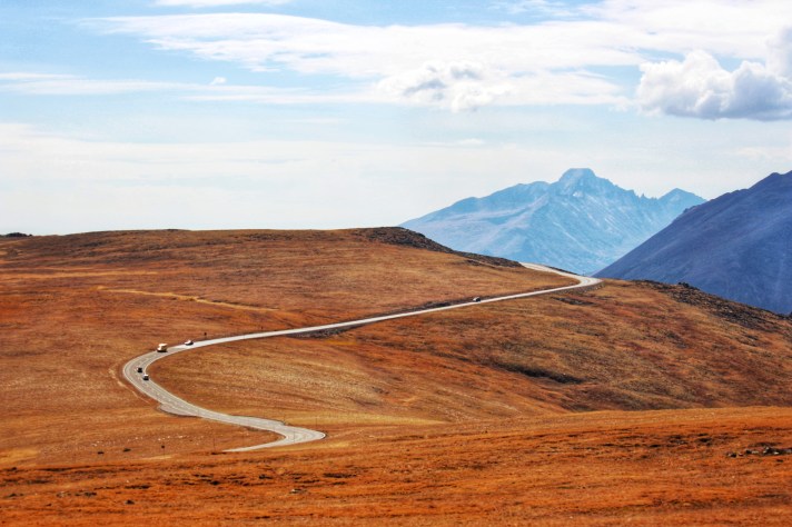
We didn’t want to waste time so we changed our plan to start our road trip on Trail Ridge Road to Alpine Visitor Center. Trail Ridge Road is the highest paved road in the country. Due to the extreme weather, it only opens around May to October. It took us approximately 4 hours round way including several stops for scenic views and the hassle of traffic. (Google map)
Here are some photos I captured on Trail Ridge Road:

Rainbow Curve Overlook
Rainbow Curve is at the outer edge of the switchback of Trail Ridge Road. It provides the views of Horseshoe Park, Hidden Valley, Beaver Ponds, Fall River, etc. It marks the transition from sub-alpine forest (below) to alpine tundra (up).
Trail Ridge Road
Forest Canyon Overlook
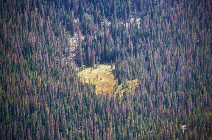
Forest Canyon reflects the power of glacier activity. We witnessed a fire burning around Forest Canyon area on Sep. 1st. The park news released later and said 80% of total 6 acres Forest Canyon was contained. The fire was believed to be caused by a lightning storm passed through on Thursday.[6]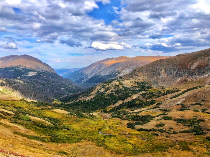
Alpine Vistor Center Overlook
Alpine visitor center is the highest visitor center across country. We hiked a quarter mile round way on Alpine Ridge Trail to the elevation of 12,005 feet above sea level. Before the sky getting dark, we drove back to Bear Lake trailhead and hiked two short trails to Bear Lake and Nymph Lake.

Bear Lake
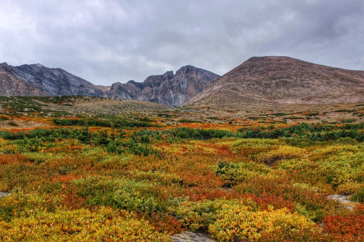
Day 2: Chasm Lake Trail
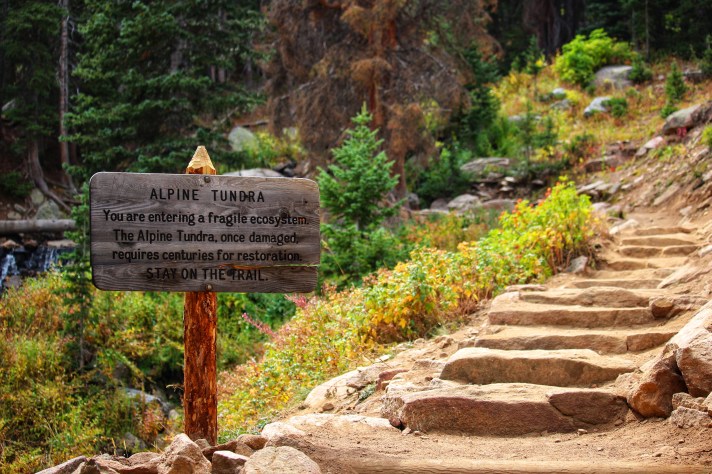
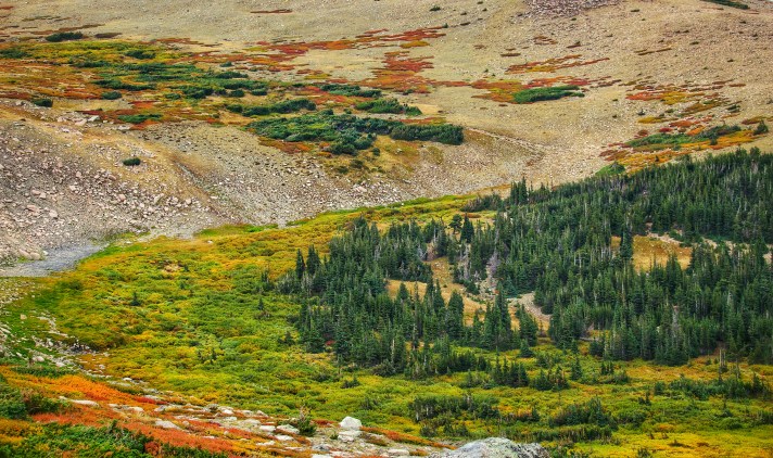
We planned to try a hard trail on second day – Chasm Lake Trail. This trail is featured by views of high altitude, wildlife, and alpine tundra and lakes. What is the alpine tundra? It is a typical natural area that trees can not grow because of the cold and windy weather caused by high altitude. When elevation goes higher, the region is transitioning to from montane zone to sub-alpine zone to alpine zone.[7]


I was very proud of myself for finishing this trail, since it broke my last hiking record in Yosemite NP. 😛 It’s time to showoff!
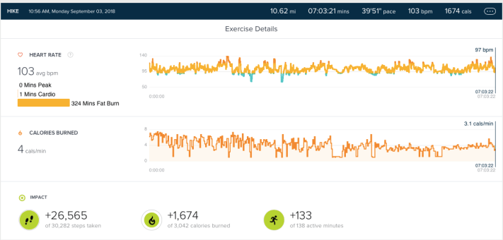
Data from Fitbit
Day 3: Half day in Southwest
On the last day, we passed through the RMNP from northeast and exited the park at southwest entrance. We stoped at Continental Divide Milner Pass. The divide separates the drainage to the Atlantic from the drainage to Pacific.
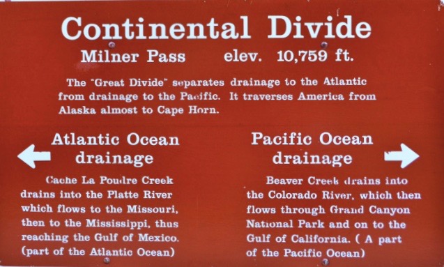
Continental Divide at Milner Pass

Lake Granby
Other Resources for RMNP:
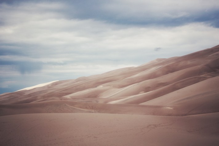
– Great Sand Dunes National Park –
Great Sand Dunes National Park is located at south of Denver with approximately 4 hours drive. It has the tallest sand dunes in North America and consist a diverse ecosystem: wetlands, grasslands, creeks, dunes, forests, alpine lakes, and alpine tundra. In spring and summer, visitors are able to get across Medano Creek to reach dunes. However, when we arrived, there is no water at all since usually the creek has a peak flow from May to June.[8]Sandsledding and sand boarding are popular activities in Great Sand Dunes NP. Those equipment could be rent at three places[9]: